R. Baroudi: «Απόλυτα εφικτό η Ελλάδα να αποτελέσει στρατηγικό ενεργειακό κόμβο για την Ευρώπη»


Ένα από τα σημαίνοντα στελέχη της παγκόσμιας ενεργειακής αγοράς εξηγεί πώς προέκυψε η τέλεια ενεργειακή καταιγίδα – Τι λέει για τις άστοχες πολιτικές της Ευρώπης
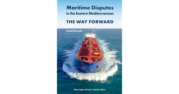
O Roudi Baroudi έχει 40 χρόνια διεθνή εμπειρία στους τομείς του πετρελαίου και του φυσικού αερίου, των ανανεώσιμων και πράσινων πηγών και των ενεργειακών υποδομών. Η καριέρα του ξεκίνησε από τις Ηνωμένες Πολιτείες το 1978, πέρασε από την Παγκόσμια Τράπεζα, το ΔΝΤ και την Ε. Επιτροπή και τον έφερε στην περιοχή της Ανατολικής Μεσογείου, περιοχή που έχει μελετήσει βαθιά και για την οποία έχει γράψει το βιβλίο με τίτλο «Maritime Disputes in the Eastern Mediterranean: The Way Forward».
Διευθύνων σύμβουλος, πλέον, της Energy & Environment Holding του Κατάρ μετέχει στο 10ο «Athens Energy Dialogues» και μιλώντας στο newmoney επιμένει ότι μία συνεργασία Ελλάδας και Τουρκίας στον χώρο της ενέργειας είναι και δυνατή και αμοιβαία επωφελής, αν και όχι απολύτως ανώδυνη. Επίσης, προκαλεί αισιοδοξία η πεποίθησή του ότι έχει ξεκινήσει η διαδικασία αποκλιμάκωσης του κόστους της ενέργειας στην Ευρώπη.
-Ποια είναι η εκτίμησή σας για την ενεργειακή κρίση; Πόσο θα κρατήσει; Υπάρχει διέξοδος από αυτή χωρίς τη Ρωσία;
«Προφανώς είναι ένα πολύ σοβαρό πρόβλημα, όχι μόνο για την Ευρώπη, αλλά και για ολόκληρο τον κόσμο, καθώς επηρεάζει τόσες πολλές πτυχές της καθημερινότητας, από την τιμή του ηλεκτρικού ρεύματος έως τη βενζίνη, τις μεταφορές γενικότερα, την τροφική αλυσίδα κ.λπ. Είναι πολύ δύσκολο να προβλέψουμε πόσο θα διαρκέσει, καθώς ο πόλεμος μόλις ξεκίνησε. Η πρόβλεψη μιας ημερομηνίας λήξης είναι δύσκολο εγχείρημα, καθώς τόσο τα προβλήματα όσο και οι λύσεις έχουν πολλά κινούμενα μέρη.
Καταρχάς, το πρόβλημα είναι προϊόν πολλών παραγόντων, όπως:
- οι παλαιότερες αποφάσεις για σταδιακή κατάργηση της χρήσης άνθρακα και πυρηνικών σε ορισμένες ευρωπαϊκές χώρες
- η αποτυχία αποτελεσματικής διαφοροποίησης του συνολικού ενεργειακού καλαθιού της Ευρώπης (που οδηγεί άμεσα στην υπερβολική εξάρτηση από τις ρωσικές προμήθειες, ιδίως από το φυσικό αέριο που μεταφέρεται με αγωγούς)
- οι επακόλουθες επιπτώσεις της πανδημικής κατάρρευσης των τιμών του πετρελαίου και του φυσικού αερίου, που ανάγκασε πολλούς παραγωγούς σε όλο τον κόσμο να κλείσουν, οδηγώντας με τη σειρά του σε ανοδικές πιέσεις στις διεθνείς τιμές όταν η ζήτηση ανέκαμψε.
Ο συνδυασμένος αντίκτυπος όλων αυτών έγινε ακόμη πιο βαρύς από τη συγκυρία: η κρίση έρχεται ακριβώς τη στιγμή που αγωνιζόμαστε να πετύχουμε με τους στόχους απαλλαγής από τις εκπομπές άνθρακα, καταργώντας τα ορυκτά καύσιμα. Έτσι οι ευρωπαϊκές αγορές ενέργειας έμειναν εξαιρετικά ευάλωτες σε διακοπές εφοδιασμού – ή ακόμα και στην πιθανότητα διακοπής.
Το να ξεσπάσει ο πόλεμος στην Ουκρανία, όταν αυτό έγινε, ήταν από πολλές απόψεις το χειρότερο σενάριο, και αυτό είναι που έχουμε να αντιμετωπίσουμε.
Δεύτερον, η αποτελεσματικότητα των λύσεων θα καθοριστεί από πολλαπλές μεταβλητές που εξαρτώνται από τη σωστή λήψη και εφαρμογή των αποφάσεων, την επαρκή χρηματοδότηση τόσο από τις κυβερνήσεις όσο και από διάφορους χρηματοπιστωτικούς οργανισμούς και τη συνεργασία μεταξύ των χωρών της ΕΕ και με τους γείτονές τους στη Βόρεια Αφρική και την Ανατολική Μεσόγειο.
Η Ευρώπη έχει πολλά κουμπιά που μπορεί να πατήσει και όσο περισσότερα πατήσει, τόσο καλύτερα θα είναι τα αποτελέσματα. Μερικά από αυτά θα ήταν:
- η καθυστέρηση της σταδιακής κατάργησης του άνθρακα/πυρηνικής ενέργειας
- η ριζική αύξηση των επενδύσεων σε ανανεώσιμες πηγές ενέργειας όπως η αιολική και η ηλιακή ενέργεια
- η επέκταση των δυνατοτήτων της Ευρώπης να δέχεται και να επεξεργάζεται μεταφορά μέσω πλοίων υγροποιημένου φυσικού αερίου
- η καλύτερη αξιοποίηση τέτοιων λύσεων στην Ισπανία, με σύνδεση μέσω αγωγών με τη Γαλλία και επομένως με την υπόλοιπη Ευρώπη
- εγκατάσταση κοινών δικτύων ηλεκτρικής ενέργειας με γειτονικές περιοχές
- η στήριξη στην αξιοποίηση υποθαλάσσιων κοιτασμάτων φυσικού αερίου στην Ανατολική Μεσόγειο και
- η κατασκευή νέων αγωγών που συνδέουν τις αγορές της ΕΕ με τους παραγωγούς φυσικού αερίου στην Κεντρική Ασία.
Όσο περισσότερα από αυτά τα πράγματα κάνουμε –και κάνουμε καλά– τόσο πιο γρήγορα θα υποχωρήσει η κρίση. Όσο επιτρέπουμε να καθυστερεί η εφαρμογή τέτοιων μέτρων, τόσο περισσότερο θα διατηρηθεί η κρίση –και η ευπάθεια της Ευρώπης σε παρόμοια προβλήματα στο μέλλον.
Σε τελική ανάλυση, λοιπόν, ναι, μπορούμε να βγούμε από την κρίση, αλλά δεν υπάρχει ένα μόνο μονοπάτι που θα οδηγήσει εκεί. Και ναι, μπορούμε να το κάνουμε με ή χωρίς τη συμμετοχή των Ρώσων, αλλά φυσικά η διαδικασία θα ήταν πολύ πιο εύκολη αν με κάποιο τρόπο συμμετείχαν σε αυτή».
-Πιστεύετε ότι οι τιμές της ενέργειας είναι δυνατό να επιστρέψουν ξανά στα επίπεδα του 2020; Θα πρέπει οι Ευρωπαίοι να προσαρμοστούν στο να ζουν με ακριβό ηλεκτρικό ρεύμα και καύσιμα; Τι θα σήμαινε αυτό για την ευρωπαϊκή οικονομία;
«Μεσομακροπρόθεσμα, με την προϋπόθεση ότι θα λάβουμε όλα ή τα περισσότερα από τα μέτρα που ανέφερα προηγουμένως, οι τιμές της ενέργειας σίγουρα θα επιστρέψουν μια μέρα στα επίπεδα του 2020, αλλά όχι στις αρνητικές τιμές που παρατηρήθηκαν για σύντομο χρονικό διάστημα, όταν ο COVID-19 κατακρήμνισε τη ζήτηση.
Όπως είμαι βέβαιος ότι γνωρίζετε, οι τιμές πετρελαίου και φυσικού αερίου συνδέονται όχι μόνο με τις αντίστοιχες καταστάσεις προσφοράς και ζήτησης, αλλά και μεταξύ τους. Οι συνθήκες που προκάλεσαν αρνητικές τιμές ήταν εξαιρετικά ασυνήθιστες, και ακόμη κι αν προσεγγίζαμε ξανά αυτά τα επίπεδα, από τη φύση τους δεν θα μπορούσαν να διαρκέσουν πολύ.
Ωστόσο, οι τιμές μπορούν να μειωθούν και η διαδικασία βρίσκεται ήδη σε εξέλιξη.
Ήδη σήμερα, πολλές υπεύθυνες χώρες αυξάνουν την παραγωγή πετρελαίου και φυσικού αερίου για να βοηθήσουν στην ηρεμία των αγορών στην Ευρώπη και αλλού. Ωστόσο ορισμένες άλλες χώρες αρνούνται να το κάνουν, ενώ κάποιες άλλες βρίσκονται υπό κυρώσεις, που τις εμποδίζουν να φέρουν στην αγορά αρκετά εκατομμύρια βαρέλια που είναι απαραίτητα για να πέσουν οι τιμές.
Προς το παρόν, οι Ευρωπαίοι δυσκολεύονται πολύ να αντιμετωπίσουν το κόστος ηλεκτρικής ενέργειας και καυσίμων, ειδικά εδώ στην Ελλάδα, όπου οι τιμές της ενέργειας είναι απίστευτα υψηλές. Η Γερμανία είναι ένα άλλο παράδειγμα.
Δεδομένης της κατάστασης, και επειδή είναι η ταχύτερη διαθέσιμη μέθοδος, ορισμένες ευρωπαϊκές χώρες πρέπει να αναστείλουν ή να ανακαλέσουν τις αποφάσεις τους να κλείσουν τους πυρηνικούς σταθμούς και τους σταθμούς ηλεκτροπαραγωγής με άνθρακα. Πρέπει να καθυστερήσουν το κλείσιμο για άλλα πέντε έως επτά χρόνια και ίσως να κατασκευάσουν επίσης ένα ή δύο νέα εργοστάσια άνθρακα, για να αντιμετωπίσουν την αυξανόμενη ζήτηση και να περιορίσουν την ανοδική πίεση στις τιμές μέχρι να προστεθούν στο δίκτυο άλλες πηγές ενέργειας.
Παρά την πιθανότητα οι τιμές να υποχωρήσουν τελικά, βραχυπρόθεσμα έως μεσοπρόθεσμα, οι Ευρωπαίοι πρέπει οπωσδήποτε να προσαρμοστούν. Μελέτες έχουν δείξει ότι οι αυξημένες τιμές της ενέργειας θα σημαίνουν μειωμένη οικονομική ανάπτυξη, ειδικά στη Γερμανία.
Αυτό σημαίνει ότι περισσότεροι άνθρωποι θα έχουν λιγότερα μέσα για να αντεπεξέλθουν στις υψηλότερες τιμές ενέργειας και αυτό καθιστά καθήκον των ηγετών της ΕΕ και των εθνικών κυβερνήσεων να αναπτύξουν πολιτικές και μηχανισμούς για να αμβλύνουν το πλήγμα, ειδικά για τις οικογένειες με χαμηλότερο εισόδημα».
-Η ελληνική κυβέρνηση ζητά από την ΕΕ «στοχευμένη και προσωρινή παρέμβαση» στη χονδρική αγορά φυσικού αερίου για τη μείωση των τιμών. Πιστεύετε ότι μια τέτοια παρέμβαση είναι εφικτή, και αν ναι, τι αντίκτυπο θα μπορούσε να έχει;
«Είναι σίγουρα εφικτή. Υπάρχουν περιστάσεις όπου η ΕΕ θα πρέπει να βοηθήσει τα κράτη-μέλη, όπως σε περιόδους πολέμου, και η τρέχουσα κατάσταση είναι εξαιρετική, πρωτοφανής μετά τον Β’ Παγκόσμιο Πόλεμο. Με αυτήν την εξαιρετική κατάσταση πραγμάτων, η ελληνική κυβέρνηση –όπως κάθε άλλο κράτος μέλος– μπορεί και πρέπει να προτείνει βιώσιμους δρόμους προς τα εμπρός, π.χ. ανώτατα όρια στο αυξανόμενο κόστος ηλεκτρικής ενέργειας, πετρελαίου ή/και άλλων ενεργειακών δαπανών. Με τη βοήθεια της ΕΕ, η κυβέρνηση θα πρέπει να μπορεί να επιδοτεί ορισμένους καταναλωτές χαμηλού επιπέδου, για παράδειγμα νοικοκυριά των οποίων η κατανάλωση είναι μικρότερη από 100 KWh την ημέρα».
-Έχετε γράψει ένα βιβλίο με τίτλος «Ναυτιλιακές διαφορές στην Ανατολική Μεσόγειο: Ο δρόμος προς τα εμπρός». Πιστεύετε ότι υπάρχει περιθώριο για ειρηνική συνεργασία Ελλάδας, Κύπρου και Τουρκίας στον ενεργειακό τομέα και εάν ναι, ποια θα ήταν τα μέσα για να επιτευχθεί;
«Ναι, πιστεύω ακράδαντα ότι η Ελλάδα, η Κύπρος και η Τουρκία θα μπορούσαν και θα έπρεπε να βρουν τρόπους συνεργασίας στον ενεργειακό τομέα, και υπάρχουν αρκετοί τρόποι με τους οποίους η συνεργασία θα προσφέρει πολλά πλεονεκτήματα.
Το ένα είναι η εξερεύνηση και η εκμετάλλευση κοιτασμάτων πετρελαίου ή/και φυσικού αερίου κάτω από τον βυθό της Ανατολικής Μεσογείου, όπου τα μέρη θα μπορούσαν να μοιραστούν το κόστος, να μοιραστούν δεδομένα, να μειώσουν τις επικαλύψεις, να επενδύσουν το ένα στα κοιτάσματα του άλλου κ.λπ.
Το ίδιο θα μπορούσε να ισχύει και για τα υπεράκτια αιολικά πάρκα.
Ένας άλλος τρόπος είναι η κατασκευή ενός ή περισσότερων αγωγών που θα μετέφεραν αέριο από τη νοτιοανατολική Μεσόγειο στην Ευρώπη χωρίς να χρειάζεται όλη η διαδρομή να γίνεται κάτω από το νερό: ο αγωγός θα μπορούσε να φτάσει έως την τουρκική ακτή και ο υπόλοιπος να συνέχιζε από την στεριά.
Δυνητικά, οι τρεις χώρες θα μπορούσαν επίσης να συνεργαστούν για να κατασκευάσουν μια μονάδα LNG, μια τεράστια επένδυση που γίνεται πιο ελκυστική αν διαμοιραστεί το ρίσκο. Σίγουρα πάντα υπάρχει χώρος για ειρήνη και πάντα υπάρχει χώρος για διπλωματία. Ο δρόμος προς τα εμπρός είναι η Ελλάδα και η Τουρκία να συνεχίσουν τις συζητήσεις τους με βάση τις αρχές της Σύμβασης του ΟΗΕ για το Δίκαιο της Θάλασσας (UNCLOS) που είναι ο Άτλαντας του Παγκόσμιου Ωκεανού. Σε αντίθεση με την Κύπρο, ούτε η Ελλάδα ούτε η Τουρκία έχουν υπογράψει την UNCLOS, αλλά οι κατευθυντήριες γραμμές και τα δεδικασμένα της ισχύουν – και μπορούν να εφαρμοστούν – από όλες τις χώρες. Η UNCLOS παρέχει μια νομική και τεχνική υποδομή με την οποία η Ελλάδα και η Τουρκία, ως κύρια μέρη, θα μπορούσαν να καθίσουν και, με αναφορά σε έρευνες που χρησιμοποιούν την τελευταία λέξη της επιστήμης και τεχνολογίας, να καταλήξουν σε μια δίκαιη και ισότιμη θαλάσσια λύση.
Τόσο ο Πρωθυπουργός Μητσοκάκης όσο και ο Πρόεδρος Ερντογάν έχουν εκφράσει την προθυμία τους να επιλύσουν αυτή τη σύγκρουση και πιστεύω ότι αυτή τη στιγμή είναι η κατάλληλη για να γίνει.
Στο βιβλίο μου, έχω επισημάνει μελέτες που δείχνουν ότι και οι δύο χώρες θα έχαναν ορισμένες θαλάσσιες περιοχές, αλλά και οι δύο χώρες θα κέρδιζαν πολύ περισσότερα: την ομορφιά ενός αποτελέσματος win-win, στο οποίο και οι δύο γείτονες θα μπορούσαν να επωφεληθούν από τον πλούτο του πετρελαίου και του φυσικού αερίου της περιοχής, ενώ και οι δύο λαοί θα μπορούσαν να απολαμβάνουν ειρήνη και ευημερία.
Φυσικά, αυτού του είδους η συνεργασία εξαρτάται από τη φιλική δέσμευση, και αυτή τη στιγμή αυτό ακούγεται δύσκολο, αλλά, όπως εξηγεί το βιβλίο, υπάρχουν τρόποι να επιλυθούν ορισμένες από τις διαφορές μεταξύ των τριών χωρών, ειδικά των διαφορών που σχετίζονται με τα θαλάσσια σύνορα.
Το επόμενο βιβλίο μου, «Κλίμα και ενέργεια στη Μεσόγειο», προχωρά ακόμη περισσότερο προτείνοντας συνεργασία σε όλη την ευρωμεσογειακή περιοχή. Ένα από τα παραδείγματα που μπορούμε να δούμε είναι η Κασπία, όπου πέντε χώρες – Αζερμπαϊτζάν, Ιράν, Καζακστάν, Ρωσία και Τουρκμενιστάν – βρήκαν μια πολύ δημιουργική λύση. Βασικά, συμφώνησαν να εφαρμόσουν ένα σύνολο κανόνων για τον βυθό της θάλασσας και ένα άλλο για το νερό και τους πόρους του. Αυτή η συμφωνία δεν είναι τέλεια, και ορισμένες πτυχές πρέπει ακόμη να αποτελέσουν αντικείμενο διμερών διαπραγματεύσεων, αλλά η συμφωνία επέτρεψε σε κάθε χώρα να πάρει τουλάχιστον μερικά από αυτά που ήθελε και να συνεχίσουν με την εκμετάλλευση των αντίστοιχων μεριδίων τους».
-Η Ελλάδα φιλοδοξεί να γίνει στρατηγικός ενεργειακός κόμβος για την Ευρώπη. Είναι αυτό εφικτό και αν ναι τι οφέλη θα αποφέρει στη χώρα;
«Είναι απολύτως εφικτό. Ανάλογα με τις ποσότητες που διαθέτουν, κάθε χώρα της Ανατολικής Μεσογείου που καταλήγει να παράγει πετρέλαιο και φυσικό αέριο μπορεί να γίνει τουλάχιστον σε κάποιο βαθμό ενεργειακός κόμβος. Κοιτάζοντας πίσω, πριν από 10 χρόνια, η Κύπρος είχε την ευκαιρία να γίνει ένας ωραίος περιφερειακός κόμβος αγωγών και τερματικού σταθμού LNG, και εάν η ανάπτυξη συνεχίσει να αυξάνεται, έχει ακόμα μια καλή ευκαιρία να πραγματοποιήσει αυτές τις προβλέψεις. Η Ελλάδα θα μπορούσε επίσης να γίνει σημαντικό ενεργειακό κέντρο την επόμενη δεκαετία, εάν επιβεβαιωθούν κοιτάσματα ανάλογα με αυτά που βρέθηκαν σε άλλες χώρες της Ανατολικής Μεσογείου, όπως η Αίγυπτος και το Ισραήλ. Πράγματι, πολλές εταιρείες του ιδιωτικού τομέα ενδιαφέρονται, αλλά αυτό πιθανότατα θα διαρκέσει 5-10 χρόνια αφού η εξερεύνηση επιβεβαιώσει επαρκείς ποσότητες υδρογονανθράκων. Τα οφέλη του κόμβου θα ήταν σημαντικά: περισσότερες καλοπληρωμένες θέσεις εργασίας για τους Έλληνες πολίτες, περισσότερα κέρδη για τις ελληνικές εταιρείες, περισσότερα έσοδα για την ελληνική κυβέρνηση, περισσότερα διαθέσιμα κεφάλαια για δρόμους, σχολεία και νοσοκομεία, μεγαλύτερη επιρροή στην ευρωπαϊκή και παγκόσμια σκηνή, και τα λοιπά».